The Transport System of the Netherlands
Transportation is the skeletal system of a country and a city. Urban transportation is among the important problems of today’s world. Although the transportation needs are sufficient for the period we live in, it is important that it has sufficient capacity in the future. With the increasing population, transportation systems may also be inadequate. At this point, the concept of “sustainability” for a solution emerges. Sustainability is defined as meeting the needs of future generations by minimising the damage to the environment and ensuring the efficient use of resources while meeting today’s needs. Sustainable transportation is a system in which different types of transportation are used safely for the protection of both human health and the environment; the use of pedestrians and bicycles comes to the fore, pedestrians always provide the right of way in traffic; the use of motor vehicles is reduced, and smart transportation applications are integrated. An economical, human-centred, easily accessible and safe system is aimed. For this reason, the idea of sustainability in urban transportation planning is very important.
The Netherlands is quite developed in terms of sustainable transportation and continues to develop in future generations. One of the reasons why the Netherlands is so successful in transportation is that it has geographically flat topography. However, it has succeeded in using the geography it has in the best way by establishing and implementing effective and regular policies in the transportation system and by setting rules. The cooperation of relevant institutions with transportation policies, the correct and on-site determination of problems, solution-oriented practices, and the sustainable focus of the works with sufficient capacity not only for today but also for future generations have ensured that the Netherlands has the safest and highest quality roads in Europe.
Figure 1: The Netherlands A4 Highway – Saadet Gökmen Archive
Pedestrian and bicycle, which is the focus of sustainable transportation, has become a part of life in the Netherlands. Being a water country, the Netherlands can also be called a bicycle country. Cycling is embedded in Dutch society and has become universal, and it can be easily seen that people of all ages, from children to the elderly, use bicycles. While 6-year-old children use bicycles, 70-year-olds continue their lives by cycling comfortably. Even mothers/fathers go from one place to another by bicycle with their children. People use the bicycle to meet all kinds of needs, such as going to the market, meeting with their friends, going to work, and going to school. More precisely, more than 25% of all journeys, and more than 60% in some cities, are made by bicycle. This has become a part of cycling culture. The number of bicycles in the country is more than the population of the Netherlands. While it has a population of 17 million, there are 22.1 million bicycles. A Dutch person cycles more than 1000 kilometres per year.
So, how did the use of bicycles start in the Netherlands? After the Second World War, while the economic situation of the society began to increase, the use of motor vehicles began to increase, and the parking space problems the vehicles emerged. In addition, while thousands of people lost their lives in traffic accidents, this number continued to increase over the years. The public began to oppose this, as the safety of children on the streets began to decrease due to traffic. With the oil crisis, restrictions on reducing the use of motor vehicles began. By announcing that people should adopt a less energy-dependent lifestyle, “car-free Sunday” was implemented between 1973 and 1974, and with different restrictions, people turned to bicycles, and bicycle paths began to form. The first bicycle lanes were built in The Hague and Tilburg. Various applications and facilities that will encourage the use of bicycles have been presented to the public. While providing financial support to people who want to buy a bike, tax reductions or additional fees for people who come to work by bike, areas where only bicycles are allowed, and vehicles are prohibited have started to be constituted.
Figure 2: Bicycle Paths Created by Different Methods – Saadet Gökmen Archive
Since the bicycle is used purely as a mode of transportation, there are bike paths, lanes, intersections and parks. Arrangements have been made for the use of bicycles in urban transportation, and a sustainable bicycle transportation network has been created that can be transferred to future generations. Bicycle paths may join with special bicycle lanes in vehicle traffic, may be separated from vehicle traffic by pavement level in some places, and pass through forest areas, parks and green areas in some places. The Netherlands has approximately 35,000 km of bicycle paths and infrastructure, physically separated from motor traffic.
Figure 3: Bicycle Paths Created by Different Methods – Saadet Gökmen Archive
In any case, it is possible to get from point A to point B by bicycle. Parking is just as important as going anywhere by bike.
Figure 4: Bicycle Parking Areas – Saadet Gökmen Archive
While bicycle parking spaces are a method used everywhere, as in the picture, there are also public bicycle parking areas. These parking areas are used free of charge. If you want to park your bike for longer and in a safe place, free underground car parks for up to 24 hours are also available.
Figure 5: Large Bike Parks – Saadet Gökmen Archive
All modes of transport are so integrated that the OVchipkart, which is used in public transport, is used when using the underground bicycle parks. In addition, cycling may not be possible in all weather conditions, or it may be necessary to travel long distances in intercity transportation. For this reason, trains and subways with bicycles are available and can be used only through the designated gates, or bicycles can be parked in large parking lots at train and metro stations, and travel can be continued.
The Netherlands has a modern infrastructure system with extensive road, rail, air and water connections facilitating transportation. The Netherlands, which has one of the densest road networks in the world, has 139.00 km of main roads and 3,530 km of highways. It has a highway density of 64 km per 1000 km2. Car ownership is high in the Netherlands, but it is lower compared to other countries. The busiest motorway in the Netherlands is the A13 between The Hague and Rotterdam, with a daily traffic volume of around 140,000 motor vehicles. The widest motorway is the A15/A16 south of Rotterdam. Dutch highways have variable message signs and electronic signalling systems. In this way, data such as the traffic volume and the number of vehicles passing per day are reached, and it is tried to solve the congestion on the highways. In addition, porous asphalt concrete was used on the highways to reduce the noise level, and the water was discharged for safe traffic flow in case of precipitation.
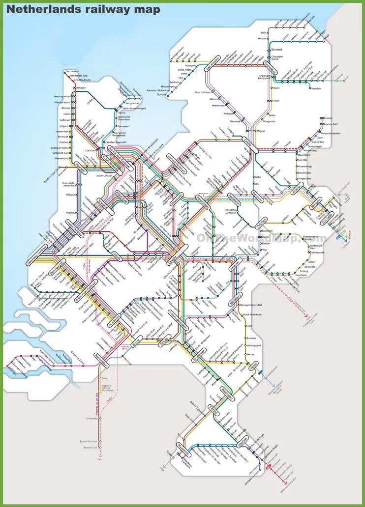
The Netherlands has a highly developed and busy railway connecting major cities and towns. Most of the distances travelled in public transport belong to the railway. There are 7,021-7,300 km of rail lengths and 3,013 km of routes in total. The national rail infrastructure is managed by ProRail. ProRail is part of NS, the owner of the Dutch railway infrastructure. Public passenger rail transport is mainly operated by Nederlandse Spoorwegen (NS) (Dutch Railways). NS lettering and logo can be seen on all boarded trains. These trains do not only connect the cities in the Netherlands but also provide an international service that provides transportation to the surrounding countries. The 4 largest train stations in the Netherlands are located in the centres of major cities, such as Amsterdam, Rotterdam, The Hague and Utrecht. The Dutch rail network serves over one million passengers a day. By 2030, ProRail predicts 45% more growth in passenger kilometres.
 Although trains are used for public transportation, especially between cities, each city has its own urban public transportation system by bus. Large cities such as Amsterdam, Rotterdam and The Hague also have their own tram systems. In the cities of Amsterdam and Rotterdam, the metro is used in public transportation. There are light rail systems that connect some cities. Rotterdam, The Hague and the suburbs in between are connected by a light rail system called RandstadRail, and a line of the Rotterdam metro system reaches The Hague Central station. Utrecht has its own light rail system, called the fast tram, which connects the city with neighbouring Nieuwegein and IJsselstein. Arnhem is the only Dutch city that still operates a trolleybus system.
Figure 7: Tram Line in Amsterdam – Saadet Gökmen Archive
In the Netherlands, some connections are provided by bridges due to waterways, while in some places, ferries serve as bridges. For example, there are ferries that connect Amsterdam Central Station to Amsterdam Noord and run non-stop, often used by cyclists and pedestrians.
![]()
From a water connection point of view, the Netherlands has 13 ports, and 3 of them are of international importance. Rotterdam is the largest port in Europe. The port of Amsterdam is the second largest in the country and the fifth-largest in Europe. Zeeland Seaports is the third-largest port. The hinterland of the port of Rotterdam reaches as far as Germany, France and Switzerland. For the European continent, it acts as a transit point for connection with overseas countries.
It has international importance in airline connections. Amsterdam Schiphol Airport is the third busiest airport in Europe. It is the second best-connected airport in the world. Other regions have much smaller international airports. These are Eindhoven Airport, Rotterdam The Hague Airport, Maastricht Aachen Airport and Groningen Airport.
It has been understood how important pedestrians and cyclists are in the Netherlands, where all modes of transport are integrated and work systematically. Pedestrians always come first in the Netherlands; cyclists and vehicles come after pedestrians. Both vehicles and cyclists must stop at a pedestrian crossing. This culture is so ingrained that every driver who sees you approaching the pedestrian crossing awaits you from the moment you step out onto the street. Just as pedestrians are important, cyclists come before vehicles. In most places, there are signs that the bike or the car has the right to pass first; where it is not, riders coming from the right always take priority, either the bike or the car. Drivers at the end of the triangle must wait on roads with triangle symbols as in the picture.
Figure 9: Priority Status on the Road – Saadet Gökmen Archive
References:
https://www.youtube.com/watch?v=1c1IysqQ2Dw
https://www.cyclistmag.com.tr/2020/04/27/hollandanin-bisiklet-devrimi/
https://polen.itu.edu.tr/bitstream/11527/4915/1/12772.pdf
https://gaiadergi.com/10-maddede-hollanda-nasil-bir-bisiklet-ulkesi-oldu/
https://www.stichtingipn.nl/bisiklet/
https://stringfixer.com/tr/Transportation_in_the_Netherlands
U.S. Central Intelligence Agency. 2014
A13 Busiest National Motorway In The Netherlands
Waard, Jan van der; Jorritsma, Peter; Immers, Ben (October 2012)
Bijna 64 miljoen—zo veel passagiers zag Schiphol nog nooit – NOS”
Figure 6: https://ontheworldmap.com/netherlands/netherlands-railway-map.html