Keystone of the Netherlands: Water

We know that the Netherlands is a water land. The Dutch meaning of the name ‘’Nederland’’ is ‘’ low land, the low country’’, which means below the sea level. %20 of the Dutch land was obtained by filling the sea or drying swamps. In fact, Amsterdam Schiphol Airport was started to be built in 1916 on the land where Lake Haarlemmermeer dried up. This lake dried up in the 1800s due to floods in cities such as Amsterdam and Leiden with storms, and settlements began to form on the lands gained afterwards. Today, pumping stations continue to operate to keep the lake dry.
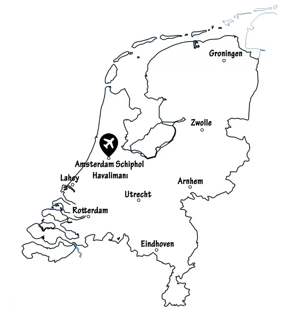
Figure 1: Amsterdam Schiphol Airport Location
Water is a part of the Netherlands. 26%, more than a quarter of the Netherlands is below sea level and 50% is 1 meter or more above. This is why the Netherlands has the best flood protection systems. Rijkswaterstaat, Ministry of Infrastructure and Water Management, and District Water Boards are responsible for preventing floods, accessing clean water, and providing equal quality water to all in the Netherlands. In addition, provinces and municipalities are also responsible for water management. The Rijkswaterstaat works on large rivers and lakes to control the water level in the North Sea and the Wadden Sea, to improve the water quality and make it suitable for both nature and agriculture. Ministry of Infrastructure and Water Management works to create flood-resistant highways, railways and waterways by providing effective water management in a clean, safe and sustainable environment. District Water Boards are responsible for regional waters such as canals and polder waterways. It is an institution that protects the country from floods, ensures that agricultural lands have access to sufficient water and that wastewater is treated. If the Netherlands had not been so experienced in water management, the map of the country would be as follows, with flooding in areas below sea level.
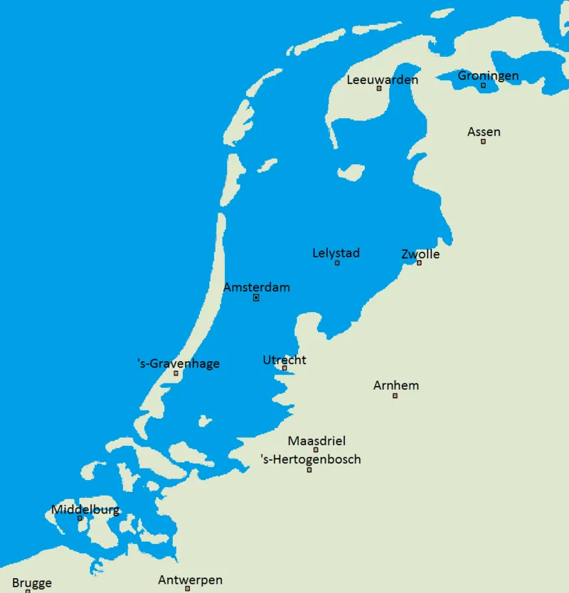
Figure 2: Map of the Netherlands in case of Flooding
One of the most important goals of the Netherlands is to deal with water. The downside of water for the Dutch is that they have been exposed to floods, and overflows throughout history. They need to constantly produce new, sustainable, smart and technological solutions against the risk of being under the water. Cities such as Amsterdam, The Hague, and Rotterdam could have been flooded if it were not for the embankments, dams, or barriers they built. Two-thirds of the Netherlands’ gross domestic product is produced on 55% of the land surface areas that are prone to flooding. So technically, in the event of a flood, the economic damage will be enormous. Sigrid Kaag, Minister of Foreign Trade and Development Cooperation of the Netherlands, said in a speech that “Thanks to the North Sea, which is our gateway to the world and at the same time a constant threat, we have become open-minded and creative people who approach every issue comprehensively”.
If we look at the Netherlands according to sea level; dark blue areas are below sea level. Dark green areas are slightly below sea level but still vulnerable to flooding. The light green, yellow and orange areas are far above mean sea level. The red lines demonstrate the sets made for natural defence.
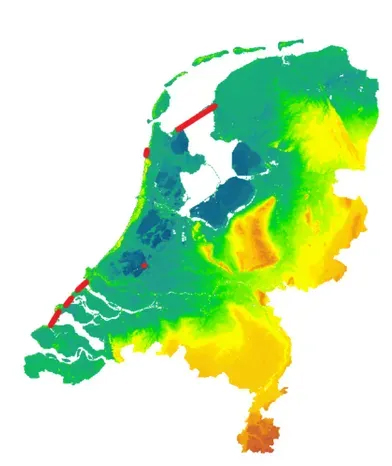
Figure 3: The Netherlands by Sea Level
The Netherlands has a unique geographical shape. It provides this originality thanks to polders, levees, water channels, and ditches. Polder means land gained from the sea with the help of embankments. To obtain a land area, the wetland is first surrounded by levees. The remaining water in the embankments is emptied and dried by windmills and electric water pumps. Even if the formed polder dries up, windmills or pumps continue to operate to keep the area dry in the future. In order to provide drainage, water channels were built and made permanent. The word set means “Dam, Dijk” in Dutch. For this reason, it is a common situation in place names in the Netherlands; Kinderdijk, Houtribdijk, Amsterdam, Rotterdam, Volendam, and Edam.
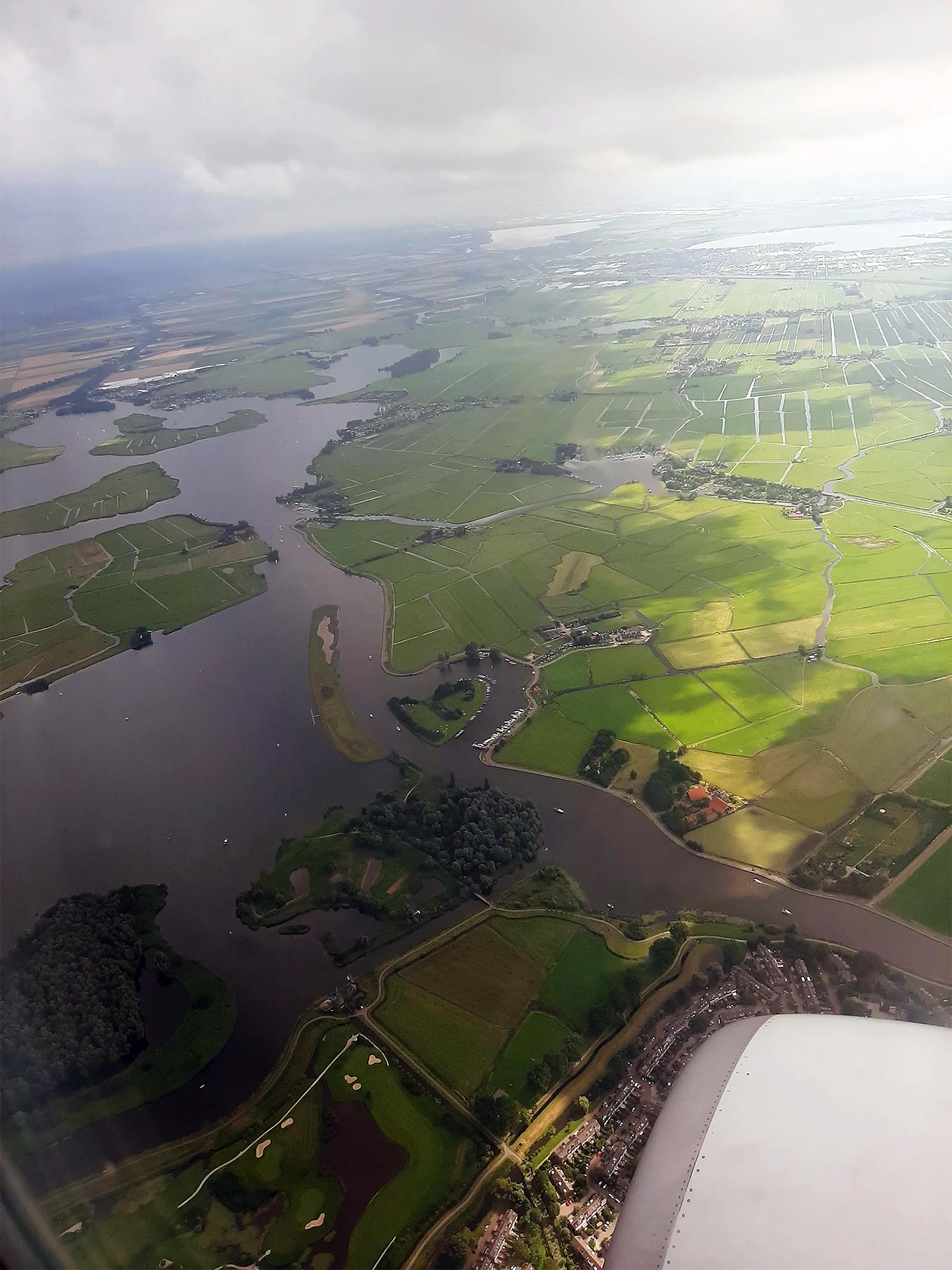
Figure 4: Aerial Polder Images – Saadet Gökmen Archive
As each country has its own symbol, the Netherlands also has many water-related symbols. The first things that come to mind when the Netherlands is mentioned are windmills, water channels, tulip gardens and wooden shoes. Watermills are elements that allow water to be evacuated in order to create soil land. For sure, it wasn’t limited to just this purpose afterwards. With the developing technology, pumps have started to be used and some windmills have lost their function. Today, there are still more than a thousand windmills. In this process, people used to wear wooden shoes called ‘’klompen’’ to keep their feet dry while working in wetlands.
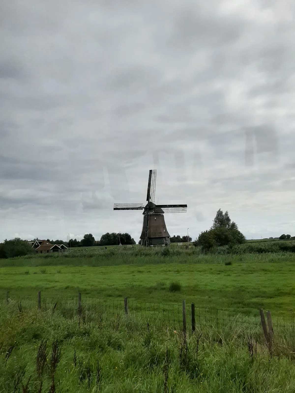
Figure 5: Volendam Watermill – Saadet Gökmen Archive
For the continuity of the acquired land, water channels were built and these channels were integrated into the cities and also used as a landscape element. On the other hand, the tulip plant was preferred because it is a species that grows fertile in sandy, rockless, and clay soils. While the tulip was grown in the Ottoman Empire, it was introduced to the Netherlands in the 16th century. Currently, the Netherlands is the world’s largest tulip producer.
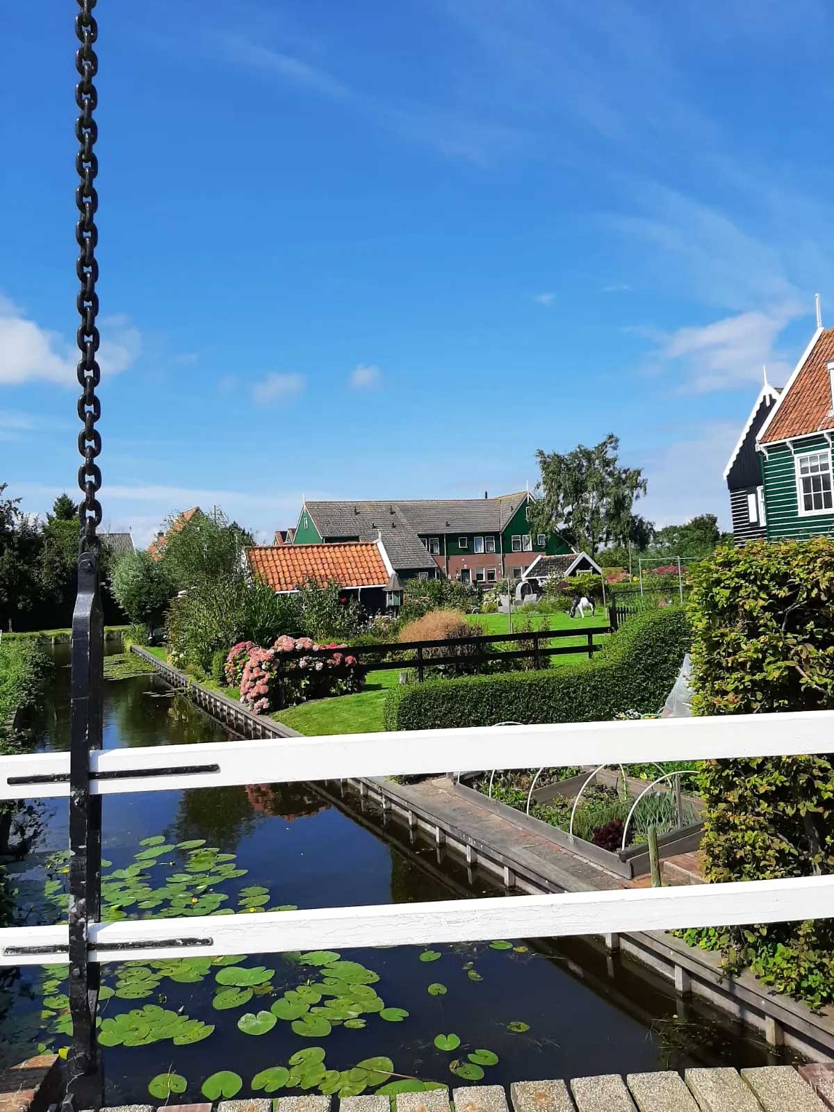
Figure 6: Water Canal in Marken – Saadet Gökmen Archive
References
https://pure-h2o-learning.eu/tr/trainer-in-chemistry-3/lo-9?showall=1
https://www.turkinfo.nl/deniz-seviyesinin-altindaki-ulke-hollanda/9323/
https://www.netherlands-tourism.com/netherlands-sea-level/
https://www.holland.com/global/tourism/information/general/dutch-water-facts.htm
https://www.rijkswaterstaat.nl/water/waterbeheer
https://www.government.nl/topics/water-management/water-management-in-the-netherlands
http://www.deltawerken.com/Watermanagement/1600.html
https://www.tandfonline.com/doi/full/10.1080/07900627.2017.1372273
https://dutchreview.com/culture/society/tulips-in-the-netherlands-dutch-thing/
Figures 2 and 3: https://netherlandsinsiders.com/how-much-of-the-netherlands-is-below-sea-level/