The Netherlands in Short

The Netherlands is a member state of the European Union within the Schengen area. It is located in North-Western Europe, and it borders Belgium to the south and Germany to the east. The area of the Netherlands is 41.543 km2, and its population was calculated as 17,199,076 on the 14th of March 2022.
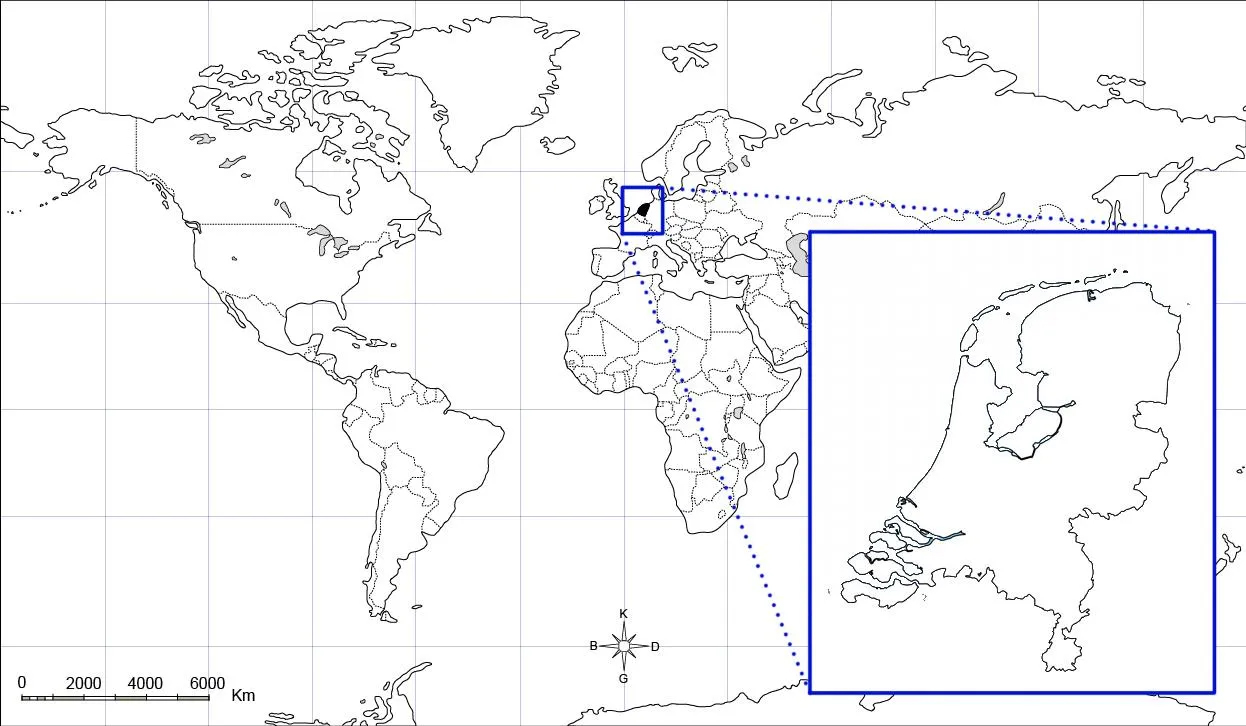
Figure 1: Location of the Netherlands in the World
The Netherlands which has slightly larger area than Konya, has a dense population. In addition, due to its geographical location, it is a highly experienced country in terms of urbanization, infrastructure, transportation and population growth. It has innovative and sustainable approaches in the way of spatial planning.
The capital of the Netherlands is Amsterdam; however, the administrative centre is the Hague. Spatial planning decisions in the Netherlands are made at national, regional, and local levels. The government, provinces, and municipalities create spatial visions by considering the expected spatial developments. While the government focuses on important planning issues for the whole country, municipalities play a role in local issues. The visions of cities on urbanization are determined specific to each one of the cities. The Netherlands has 12 provinces that represent the administrative tier. These provinces have some duties:
• Sustainable spatial development, including water management
• Environment, energy, and climate
• Regional accessibility and regional public transport
• Regional economy
• Cultural infrastructure and conversation
• Public administration
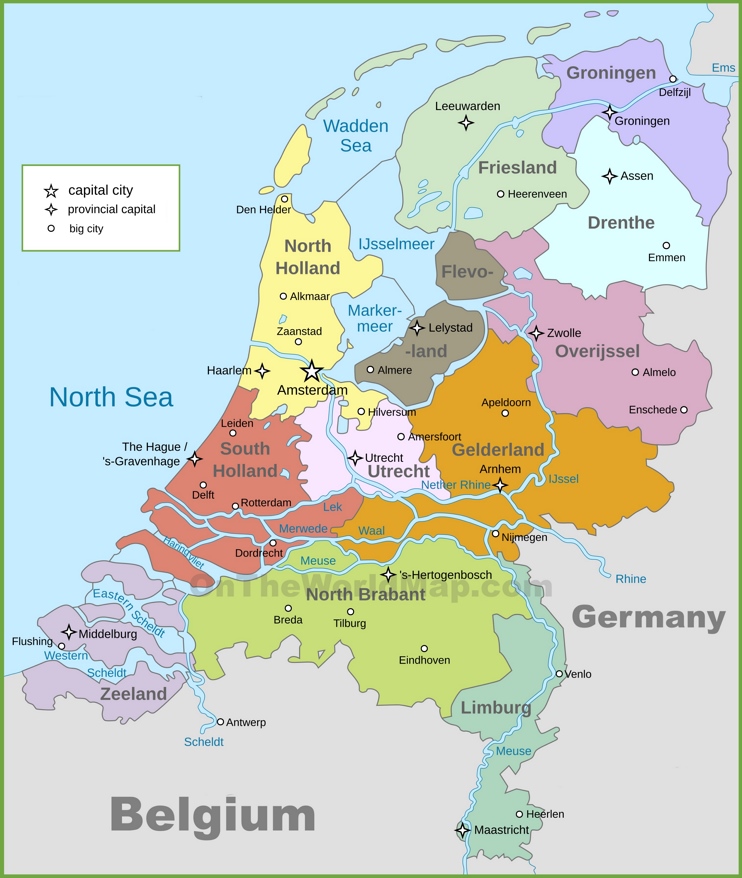
Figure 2: The Netherlands Political Map
A significant part of the Dutch territory on the Rhine, Maas and Schelde rivers flowing into the North Sea is below the water level. The Netherland is highly knowledgeable and experienced in recognizing water management, flood control, access to clean water, and struggling with climate change. If you know in advance that the Netherlands is a land of water, you will have the opportunity to observe it while on the plane.
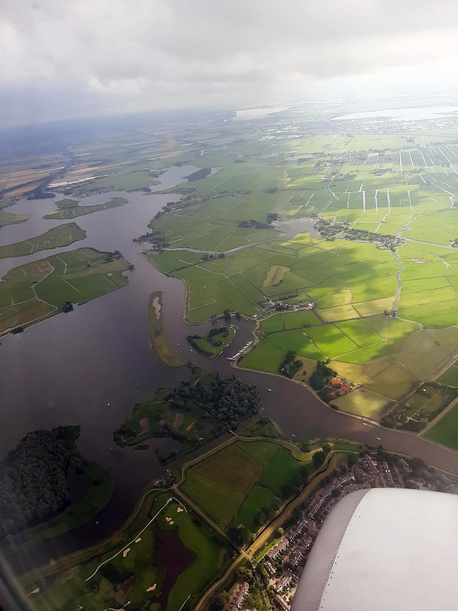
Saadet Gökmen Archieve
The Netherlands is an excellent model for city planning. It is an exemplary country when we look at its water management, energy-saving, housing and transportation policies, and planning of urban and rural settlements, such as the usage of green and public spaces.
As an urban planner candidate, I tried to experience the urban planning approach of the Netherlands for 2 months. With the help of my internship supervisor, I continued my Erasmus+ internship with a technical trip understanding by doing research on the Netherlands, taking pictures in urban areas, and meeting with people working in the field of planning.
References
Association of Provinces of the Netherlands (IPO) (in Dutch). https://www.ipo.nl/
https://www.worldometers.info/world-population/netherlands-population/
https://www.worlddata.info/europe/netherlands/index.php
Figure1: http://cografyaharita.com/haritalarim/3f_dunya_dilsiz_haritasi_rs.png
Figure2: https://ontheworldmap.com/netherlands/netherlands-political-map.html